A potential Philly flash flood could be coming on Tuesday, the National Weather Service said. The predicted downpour comes as the region is in the grip of a brutal heat wave.
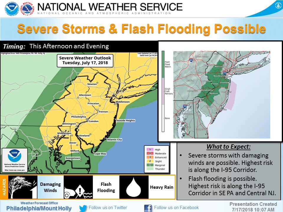
“Thunderstorms producing heavy rain could result in flash flooding across along and near the Interstate 95 corridor in New Jersey and southeastern Pennsylvania,” warned a “flash flood watch” bulletin from the National Weather Service (NWS) Mt. Holly station.
The I-95 corridor is particularly at risk, NWS said. The heaviest rain is expected in the afternoon and evening, potentially dousing the evening commute. Some one to two inches of rain is expected, with some areas possibly getting more than three inches.

“Excessive rainfall within a short period of time can lead to rapidly rising water and flash
flooding, particularly in urban areas and along small creeks and streams,” NWS said. “Rapidly rising flood waters may quickly inundate roadways and areas of poor drainage. Streams and creeks could leave their banks, flooding nearby properties.”
Philly Flash Flood Watch
The Philadelphia area could expect isolated intense storms, but even longer and more intense storms were a risk for the Jersey Shore area.
In southeastern Pennsylvania, the storms could hit counties including Philadelphia, Delaware, Eastern Montgomery and Lower Bucks. In New Jersey, Camden, Gloucester, Hunterdon, Mercer, Middlesex, Morris, Northwestern Burlington, Somerset, and Western Monmouth are all under a flash flood watch.
The storm is expected after days of heat in the mid-90s combined with high humidity levels.
The Weather Channel meteorologists forecast storms to start falling Philly by 3 p.m., lasting well into the evening.
Recent flash flooding in Southeastern Pa. was so severe and unexpected than an ‘urban exploration’ photographer was drowned, after an old sewer pipe she was photographing in Northeast Philly where no rain was falling was flooded by rainfall from hours away.


